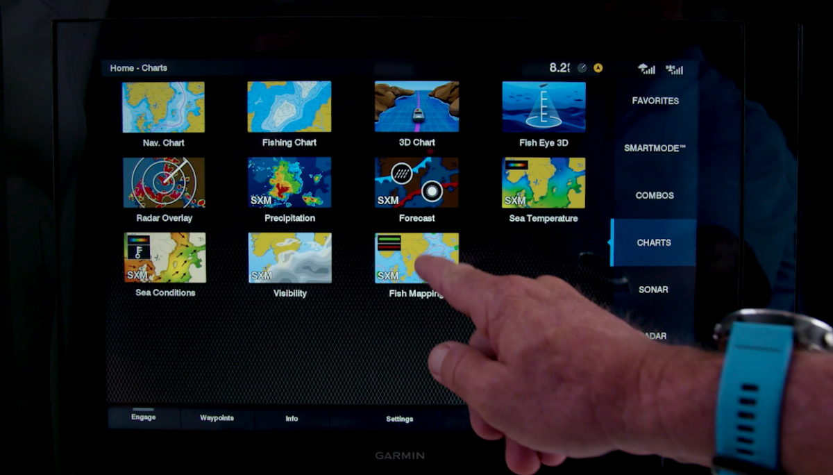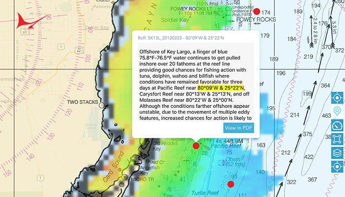


Paying a little money upfront can save you plenty when deciding which direction to run to the fishing grounds. Here in the northern Gulf, with such a large area to cover, having the knowledge of where to head before leaving the pass is a huge advantage and certainly improves our fish-to-gallon ratio. That is unless you are solely focused on fishing the oil and gas rigs to the southwest of Destin, which have recently produced some of the most impressive blue marlin numbers ever heard of in the Gulf of Mexico. Life is full of choices. Capt. Scooter Porto, aboard Fleur de Lis, caught 45 out of 63 blue marlin and also killed an 851-pounder. Capt. Chase Lake, aboard Reel Fire, had 36 bites! These are just two examples of boats that have absolutely crushed the blues this season fishing mostly live bait at the rigs. But not everyone has the means to fish these distant structures. Which way to go is often a more pressing question. There are several online forecasting services reporting water temperature and clarity, current velocity and direction, dissolved oxygen, altimetry and much more. These sites often require a monthly subscription, but some charge per use. I recommend signing up annually so you can monitor the conditions even when you arent fishing. That way you can keep up with the movement of convergence zones and ideal bands of water offshore. One site that is particularly popular in the Gulf is Hilton RealtimeNavigator (realtime-navigator.com). It provides users with satellite maps of the latest sea surface temperatures, chlorophyll and altimetry images in a user-friendly format. ROFFS (roffs.com) is another trusted pay-as-you-go service and is proven to be very successful with analyses comprising more than 20 different variables. The SiriusXM Fish Map – ping service (siriusxm.com/fishmapping) delivers science-based graphics directly on compatible Garmin multi-function displays”even when you are beyond cell phone range. There are also free sea surface temperature charts available online from Rutgers University, NOAA and NASA. The bottom line is that you need to take advantage of available technology. The days of flipping a coin to decide which way to go are long gone. Radio chatter is largely a thing of the past and for the most part you are on your own in today world of competitive sportfishing. It all satellite phones and streaming data! Sign up and see for yourself. These modern conveniences simply help us catch fish and win tournaments. Along with saving a lot of fuel and providing you with more fishing time, they largely take the guesswork out of finding filaments of blue water and current rips, directing you right to where you want to be. So, spend a little and save a lot! That my two-minute warning.